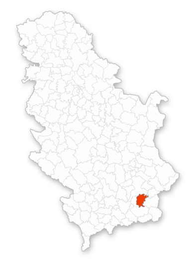
 In the northwest part of Vranjska basin, on both sides of The South Morava River, near by Grdelica Gorge has been established and still thriving Vladicin Han. With its positioning influence sphere this territory represents the part of The Balkans Peninsula central area. The town is located 67km from Macedonian border in the south and 52km from Bulgarian border in the east.
The west surrounding area belongs to The Kukakvica Mountain with its sections of which the tallest is The Vlajna Summit at 1441 meters. The town is set on the important transit roads and railway line that connect Belgrade in the north with Skopje in the south. Traveling distance from Vladicin Han to Belgrade is 333km; Pristina 112km; Novi Sad 409km; Nis 91km and Skopje 112km.
The average altitude of Vladicin Han is 328 meters and the vast majority of it is the mountainous region with the moderate continental climate. The Municipality of Vladicin Han takes up the area of 366 squared kilometers and on that territory are located 51 settlements where are dwelling 21 676 inhabitants regarding the last survey.